MIT's Senseable City Lab Makes the Case for Visual AI in Urban Research — and Lists the Costs
A new book from MIT's Senseable City Lab argues computer vision can turn street imagery into urban data at scale, while warning about surveillance creep and models that inherit cultural bias.
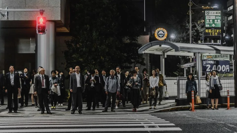
Researchers at MIT's Senseable City Lab have published a book arguing that computer vision has become a serious instrument for studying how cities work — and that the same capability carries surveillance and bias costs that cannot be engineered away. The book, "How AI Sees the City: Urban Visual Intelligence," was released this month by Routledge, according to MIT News. Its authors position visual AI as a continuation of a long tradition of looking at cities, not a break from it, while conceding that the tooling now operates at a scale earlier urbanists never had to govern.
Images as datasets
The practical argument is straightforward. MIT News describes a recent Senseable City Lab study of pollution in New York City in which machine learning was used to classify vehicle types appearing across 331 of the city's traffic cameras, with emissions then estimated per vehicle. The implied path is scale: enough cameras and enough classification accuracy, and a city could track emissions at a granularity that periodic sensor deployments or modeled traffic counts do not deliver.
Fábio Duarte, a principal research scientist and associate director of the lab and one of the book's co-authors, frames the method as treating each image as a dataset in its own right, adding that caution is warranted. Co-author Martina Mazzarello, a research scientist at the lab who leads its global initiatives, describes the shift as moving from local observation to observation "everywhere."
The other listed applications follow the same logic: diagnosing why traffic backs up, identifying which features of an intersection are most dangerous, and measuring which parts of plazas and parks draw people. The book also covers urban greenery, distinguishing between what satellite imagery captures — total tree canopy and green space — and what street-level imagery captures, which is how much greenery residents actually see day to day. That distinction matters because the reported wellness effects of green space depend on exposure, not on an overhead pixel count. Co-author Fan Zhang, an assistant professor at the Institute of Remote Sensing and GIS at Peking University, argues the value is in linking what is visible to how cities function and how people experience them, rather than in the raw volume of images processed.
One example points at a less obvious use. MIT News reports that a recent Senseable City study drew on images from 400,000 Airbnb listings worldwide and found that interior design styles are not converging globally, contrary to some claims, but still show meaningful geographic variation. The methodology behind that finding is not described in the announcement, and the listing images are a self-selected sample of short-term rental stock rather than of housing generally — a caveat worth holding onto before treating the result as a statement about global taste.
A lineage, not a rupture
The authors deliberately place AI on a continuum with earlier visual urbanism. The book traces that history from Roman marble maps through photography's role in documenting Haussmann's reshaping of Paris and crowding in New York's Lower East Side tenements in the 19th century. It also leans on two figures in particular: Kevin Lynch, the former MIT professor whose 1960 book "The Image of the City" shaped a generation of scholarship, and the sociologist William H. Whyte, who turned from "The Organization Man" to close observation of public space.
Carlo Ratti, a professor of the practice who founded and directs the lab, which MIT dates to 2004, says visual AI extends that tradition at previously impossible scale and detail. Duarte makes the same point more bluntly: Lynch worked with paper and pen, and the lab is scaling that work across many dimensions at once.
The framing is rhetorically useful — it casts AI as a tool serving human purposes — but it also glosses a real discontinuity. Lynch's methods did not require permanent camera infrastructure, and a researcher with a notebook cannot be repurposed into an enforcement system. The book's second half is essentially an acknowledgment of that gap.
The density problem
The surveillance figures cited are the sharpest numbers in the piece. MIT News reports that London, an early adopter of CCTV, has roughly 210 cameras per square mile; that eight of the world's ten most camera-dense cities are in China; and that Shanghai exceeds 5,000 cameras per square mile. The source and vintage of those counts are not disclosed, and camera-density estimates are notoriously sensitive to methodology, so the order-of-magnitude contrast is more informative than the precise figures.
The authors write that any safety benefits from intensive video recording have to be weighed against erosion of personal freedom and the potential for abuse under constant monitoring. MIT News notes that debate over traffic camera use surfaced in the United States this year, without further specifics.
For anyone building in this space, the operative issue is that a camera network justified as an emissions or congestion sensor is physically indistinguishable from one usable for identification and enforcement. The book, as described, argues for caution rather than proposing a specific technical or legal control — no retention limits, on-device processing requirements, or audit regime are mentioned in the announcement.
What the model learned to see
The bias argument is familiar but applied to an unusual object. AI systems trained predominantly on majority population groups may not evaluate minority groups consistently, the authors note, which risks producing data that confirm existing assumptions about people, neighborhoods and entire cities rather than measuring conditions. That failure mode is particularly consequential in planning, where the output is not a recommendation but a resource allocation.
Duarte puts it as a teaching problem: a model sees what is embedded in the culture that trained it, and it is not neutral. Mazzarello counters that human observation is not neutral either, and that any tool needs to be guided and trained well. Both statements are true; neither resolves who audits the training data behind a municipal deployment, and the announcement does not indicate that the book proposes a standard.
Michael Batty of University College London praised the book, calling it fascinating and saying it shows how urban design is beginning to be interpreted through urban analytics, AI and large language models. The authors conclude, per MIT News, that the technology should be explored wisely, critically and creatively — a reasonable posture, though procurement officers approving camera contracts will need something more specific.
What to watch
- Whether the New York emissions work publishes validation data — classification accuracy by vehicle type and error bars on the per-vehicle emissions estimates were not disclosed, and those figures determine whether this is a monitoring tool or an indicator.
- How cities separate sensing infrastructure from enforcement infrastructure, given that the same cameras serve both; technical controls such as on-device inference and short retention windows would be the concrete test.
- Whether the Airbnb interiors study and similar image-corpus research release their datasets and sampling methods, since platform imagery carries strong selection effects.
- Any move from principles to standards: audit requirements, demographic performance reporting, or procurement language that puts bias testing in municipal contracts.
- Whether street-level greenery exposure metrics get adopted alongside canopy-cover targets in actual planning policy, which would be an early sign that visual AI output is changing decisions rather than describing them.
Keep reading
More in Policy & Safety →
Anthropic Opens a Free, Unreviewed AI Vulnerability Scanner to Open-Source Projects
Anthropic says its OSS Scanner will send model-generated bug reports, reproducers and candidate patches to opted-in open-source projects — with no human triage before delivery.
5 min read
Anthropic Rewrites Its Usage Policy for Agents, Surveillance and Robots
Anthropic's 2026 Usage Policy consolidates deception rules, tightens weapons and surveillance language, adds controls for Claude driving physical hardware, and takes effect November 12.
5 min read
OpenAI Says It Disrupted Its First "Category 5" Influence Operation — and AI Was the Junior Partner
OpenAI banned Russian and Iranian networks running fake think tanks and journalist personas. The most striking detail: the models were used mostly for internal paperwork, not propaganda.
5 min read